Lacs de Pétarel-Col de la Béranne
Marco05
User
Length
11.1 km
Max alt
2109 m
Uphill gradient
872 m
Km-Effort
23 km
Min alt
1274 m
Downhill gradient
872 m
Boucle
Yes
Creation date :
2022-04-01 12:01:39.917
Updated on :
2022-10-11 15:33:25.541
7h00
Difficulty : Medium
FREE GPS app for hiking
About
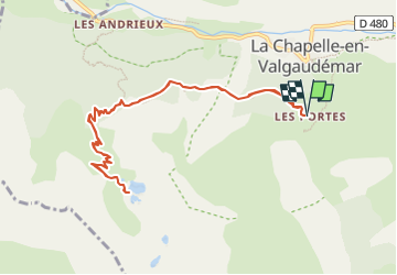
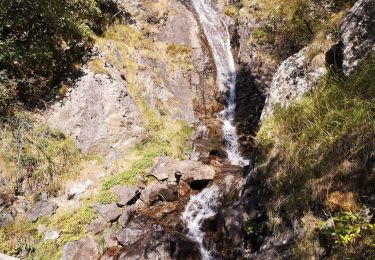
Trail Walking of 11.1 km to be discovered at Provence-Alpes-Côte d'Azur, Hautes-Alpes, La Chapelle-en-Valgaudémar. This trail is proposed by Marco05.
Description
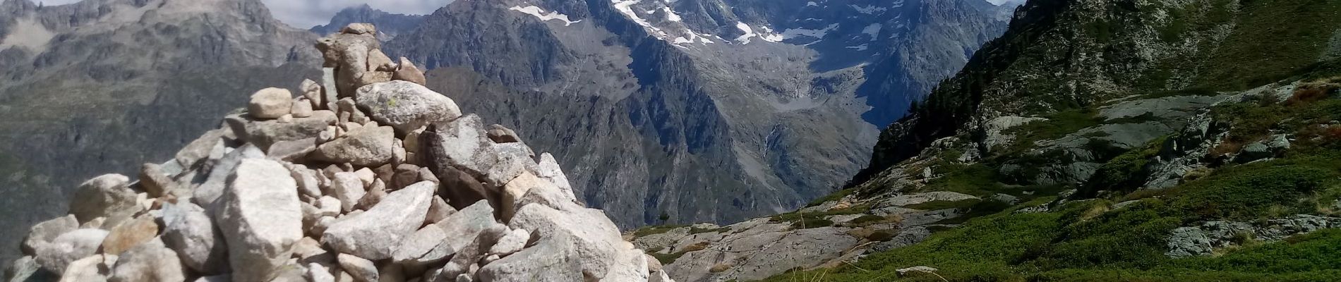
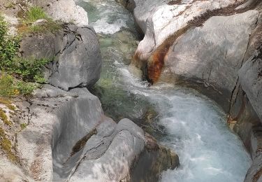
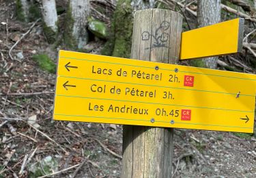
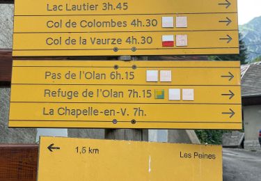
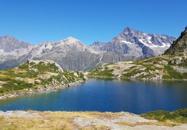
Deux beaux lacs d'altitude à atteindre à partir du hameau des Portes, au dessus de la Chapelle en Valgaudemar.
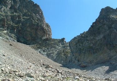
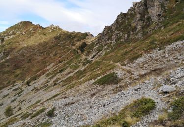
Pas de difficultés particulières à part un court passage de câble.
La vue sur l'Olan et le pic Turbat est splendide.
Positioning
Country:
France
Region :
Provence-Alpes-Côte d'Azur
Department/Province :
Hautes-Alpes
Municipality :
La Chapelle-en-Valgaudémar
Location:
Unknown
Start:(Dec)
Start:(UTM)
278237 ; 4965698 (32T) N.
Comments
Trails nearby
circuit de la cabane de l'aup .08-06-14
Walking
Very easy
(1)
La Chapelle-en-Valgaudémar,
Provence-Alpes-Côte d'Azur,
Hautes-Alpes,
France
8.8 km | 13.6 km-effort
2h 37min
Yes
Tour du Vieux Chaillol 2/5 - Du Gîte Le Casset au Refuge de Vallonpierre
Walking
Medium
(1)
La Chapelle-en-Valgaudémar,
Provence-Alpes-Côte d'Azur,
Hautes-Alpes,
France
11.8 km | 24 km-effort
4h 30min
No
Les Portes , Les cascades.
Walking
Medium
La Chapelle-en-Valgaudémar,
Provence-Alpes-Côte d'Azur,
Hautes-Alpes,
France
8.1 km | 11 km-effort
2h 25min
Yes
Pas de l'Olan
Walking
Very difficult
La Chapelle-en-Valgaudémar,
Provence-Alpes-Côte d'Azur,
Hautes-Alpes,
France
12.6 km | 34 km-effort
7h 37min
Yes
Valgo2 - J2 : Col de Pétarel
Walking
Very difficult
La Chapelle-en-Valgaudémar,
Provence-Alpes-Côte d'Azur,
Hautes-Alpes,
France
18.8 km | 38 km-effort
5h 40min
No
Valgo2 - J1 : Col des Clochettes
Walking
Difficult
Villar-Loubière,
Provence-Alpes-Côte d'Azur,
Hautes-Alpes,
France
14.6 km | 30 km-effort
4h 12min
Yes
Les Lacs de Pétarel
Walking
Difficult
La Chapelle-en-Valgaudémar,
Provence-Alpes-Côte d'Azur,
Hautes-Alpes,
France
12.5 km | 27 km-effort
5h 43min
Yes
Cime de Turbat.
Walking
Difficult
Villar-Loubière,
Provence-Alpes-Côte d'Azur,
Hautes-Alpes,
France
15.1 km | 32 km-effort
7h 31min
No
Refuge des souffles.
Walking
Medium
Villar-Loubière,
Provence-Alpes-Côte d'Azur,
Hautes-Alpes,
France
4.5 km | 13.7 km-effort
2h 1min
No